| These are links to very large satelite photos of the New Orleans area taken from the NOAA web site. All of them are over 1.5mb. They show specific levee breaks and houses only interesting to my relatives. If you want to scour all the satelite images from the NOAA site, just go to http://ngs.woc.noaa.gov/katrina/. NOTE: The date of the photography can be derived from the first 3 characters of the image name. Image names beginning with 243 were acquired Aug 30, 2005, those beginning with 244 were acquired Aug 31, and so on. |
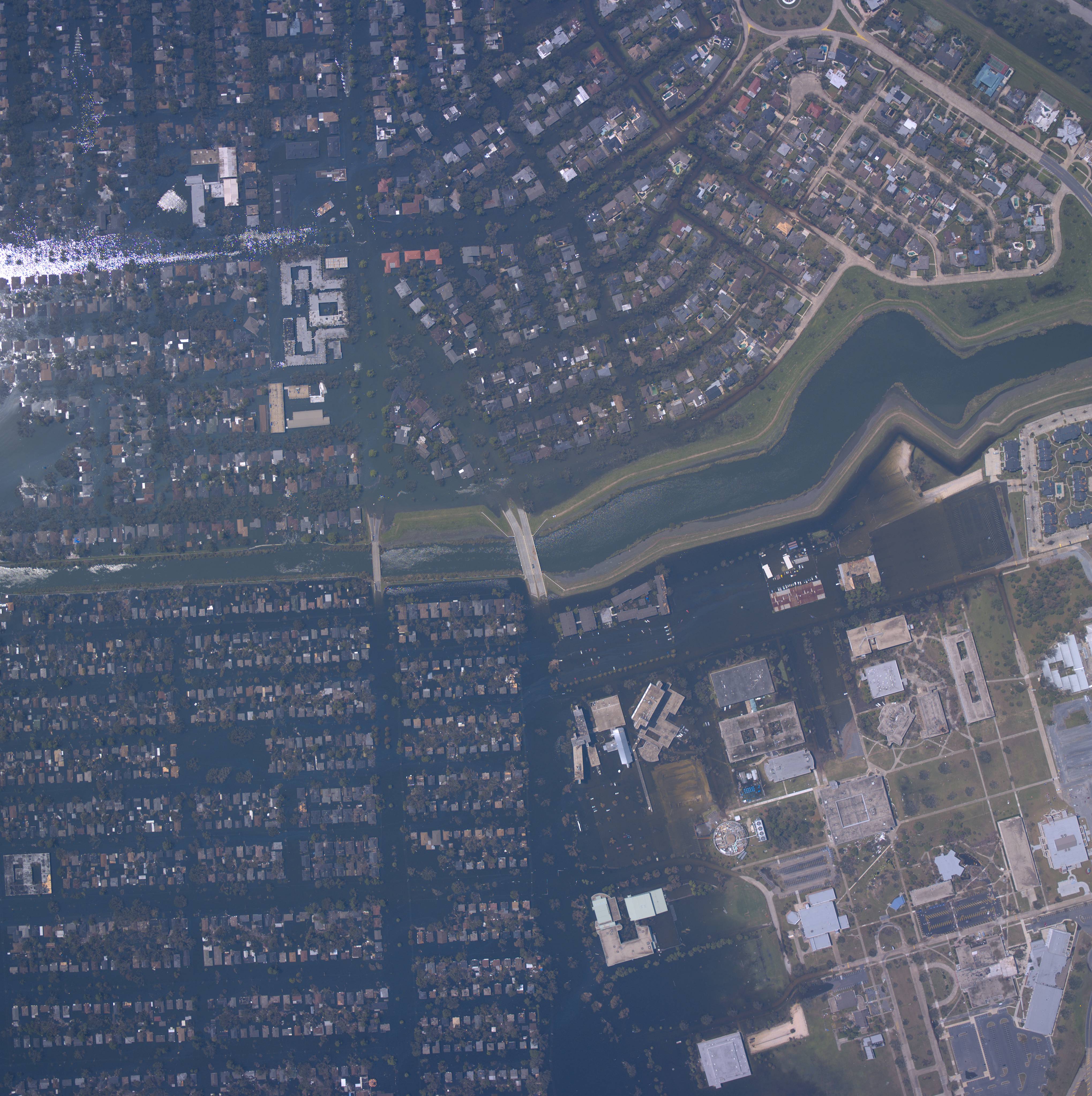
| Photo of London Ave. Canal levee break by Robert E. Lee Drive (1,671 KB) . The University of New Orleans is in the lower right side of the picture. This levee break along with the 17th Street Canal flooded Lakeview but another break along the London Ave. Canal flooded UNO's side of the canal. The break is in the mid section of the picture. When the picture is maximized in your browser, you can see boats moving along the streets. Lake Pontchatrain is just off the picture to the right. Notice the houses close to the Lake did not flood. |
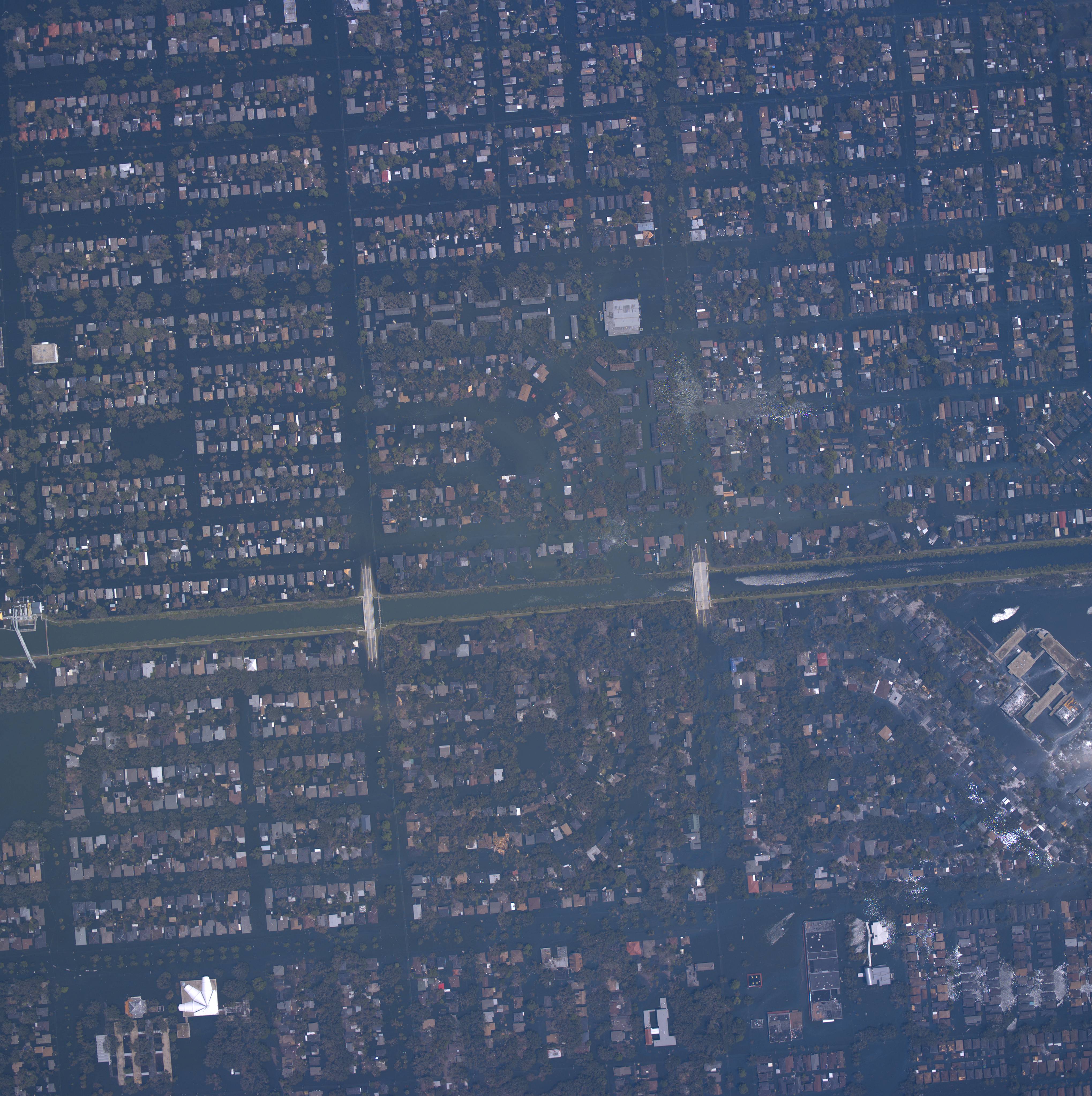
| 24425058-17th-house-wrapped-tree.jpg
(1,741 KB) Picture runs North to South (left to right). At far left is edge of break. Blue house that wrapped itself around a tree is less than 2 blocks East (up) from break. Can see boats and oil slicks from cars. |
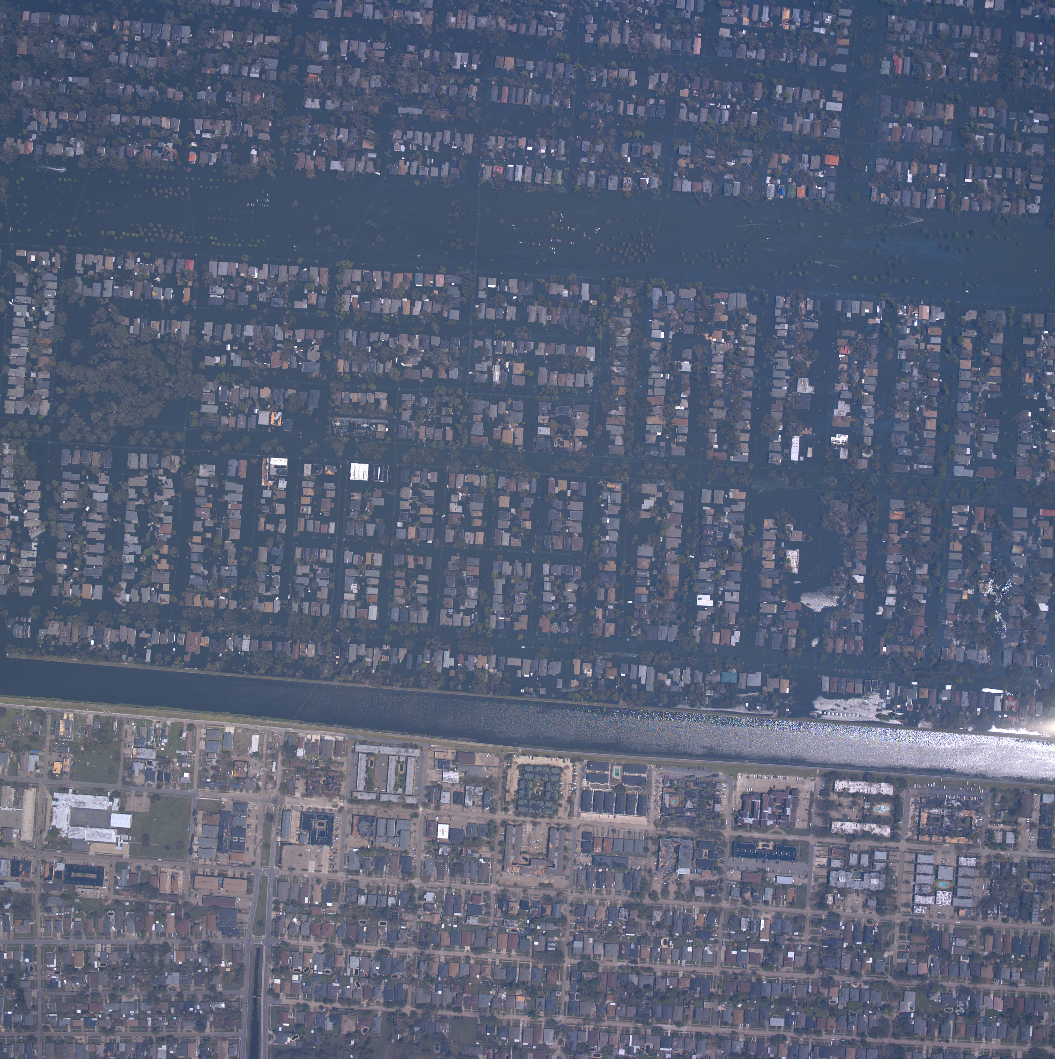
| 24425095-london-pump-station.jpg
(1,668 KB) London Ave Canal break by Mirabeau Ave. See middle of picture by bridge. Picture runs North to South (left to right). A pumping station in in the middle on the left. |
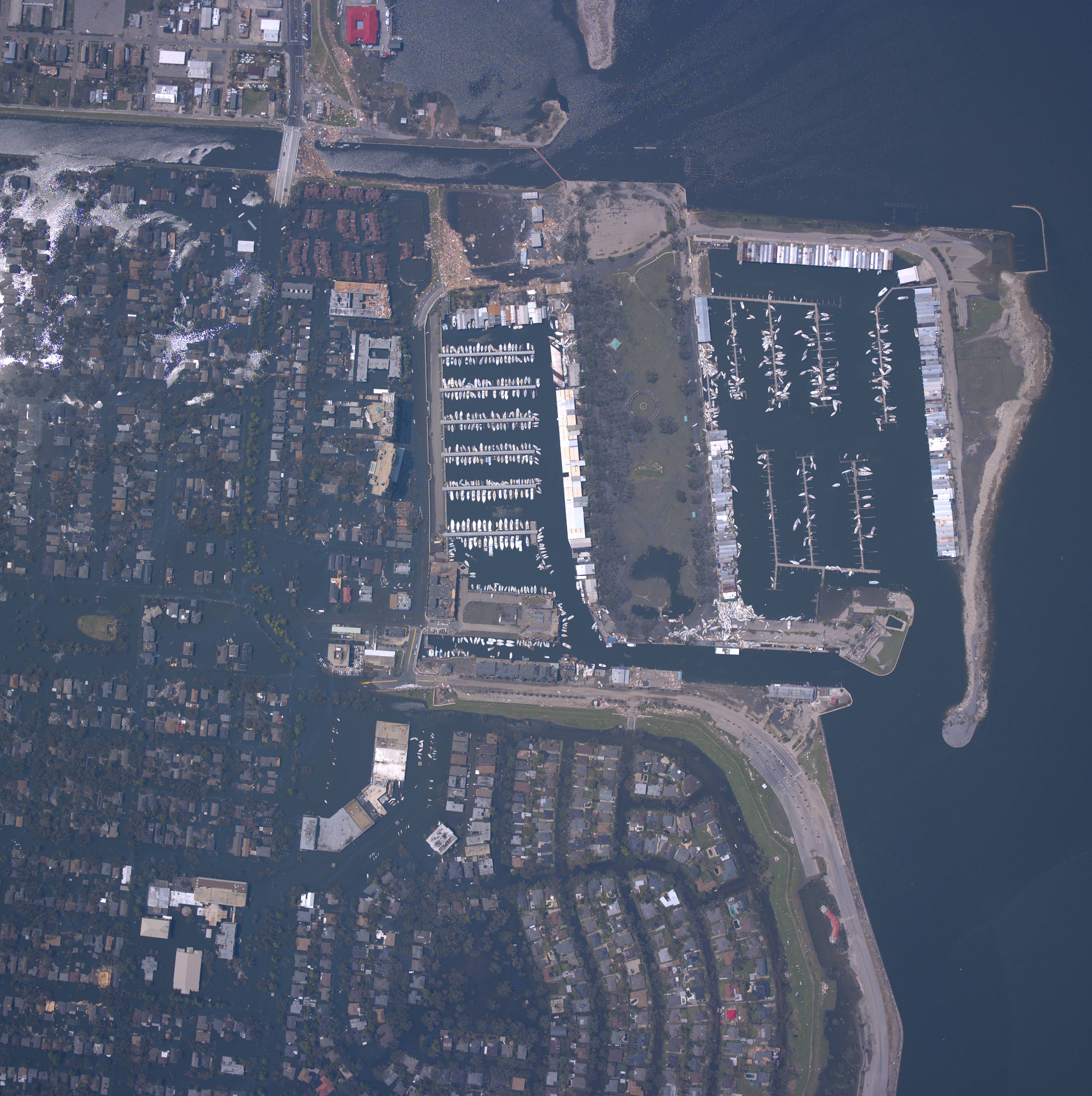
| 24425565-17th.jpg (1,572 KB) Lake end of Canal Blvd., Old Pontchatrain Beach, Bayou St. John. |
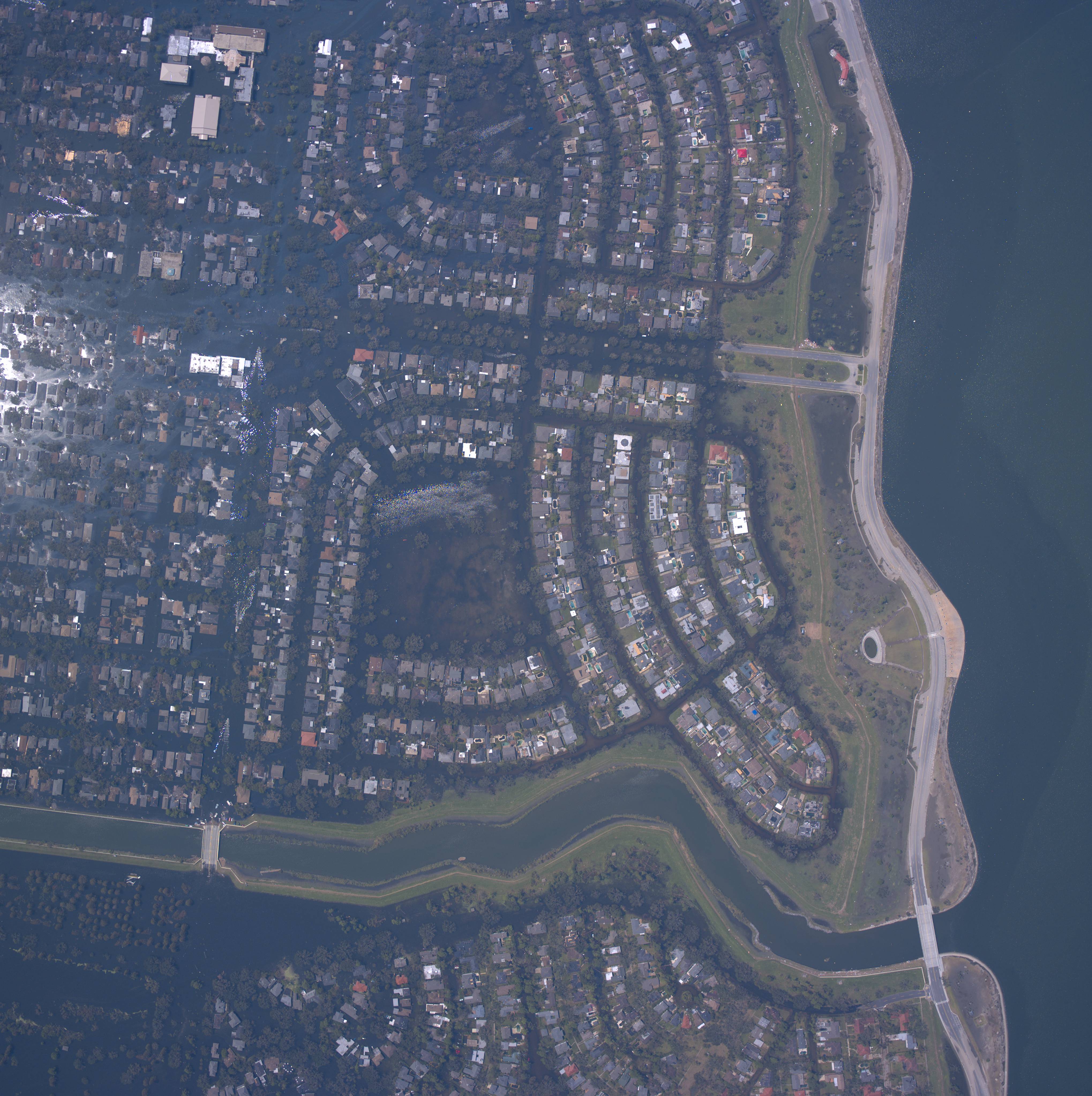
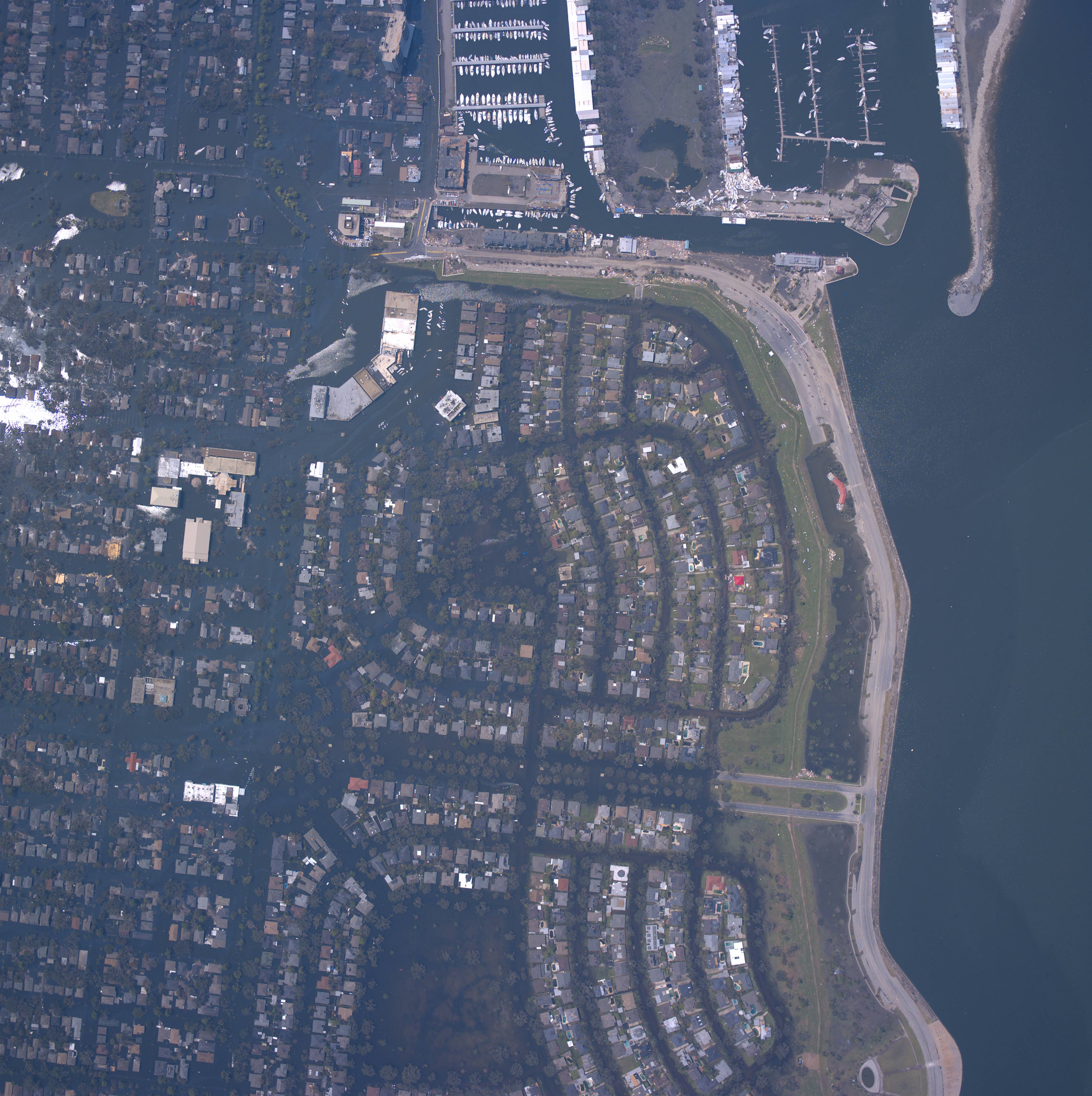
| 24425570-17th.jpg (1,582 KB) Can see lighthouse (red), point at end of Yaht club, all the boats, very exclusive gated neighborhood at end of west end blvd. Robert E. Lee Theater. Mt. Carmel |
| 24425575-17th-break.jpg (1,648 KB) Can see 17th Street canal break. Lighthouse, Yaht club, Joe's Crab Shack. |
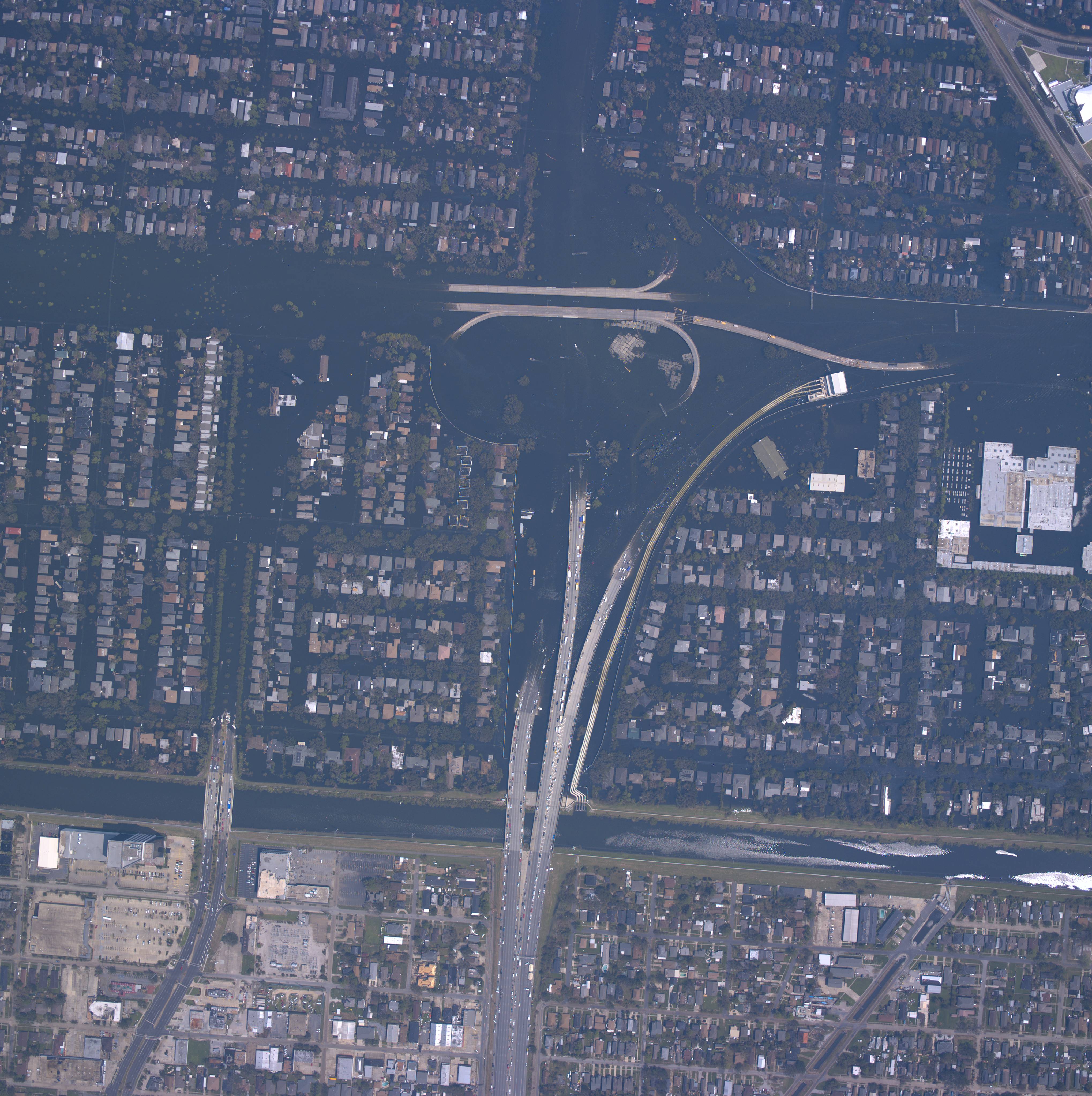
| 24426517-17-dip-on-right.jpg (1,682
KB) Can see Dip on mid-right, large pump station with pipes going to 17th street canal. Morman Church. Veterans Hwy and I-10 cross canal. Can see rail road tracks until just before they cross over the dip. The dip is the Mound Ave Crossing by the cemetaries. |
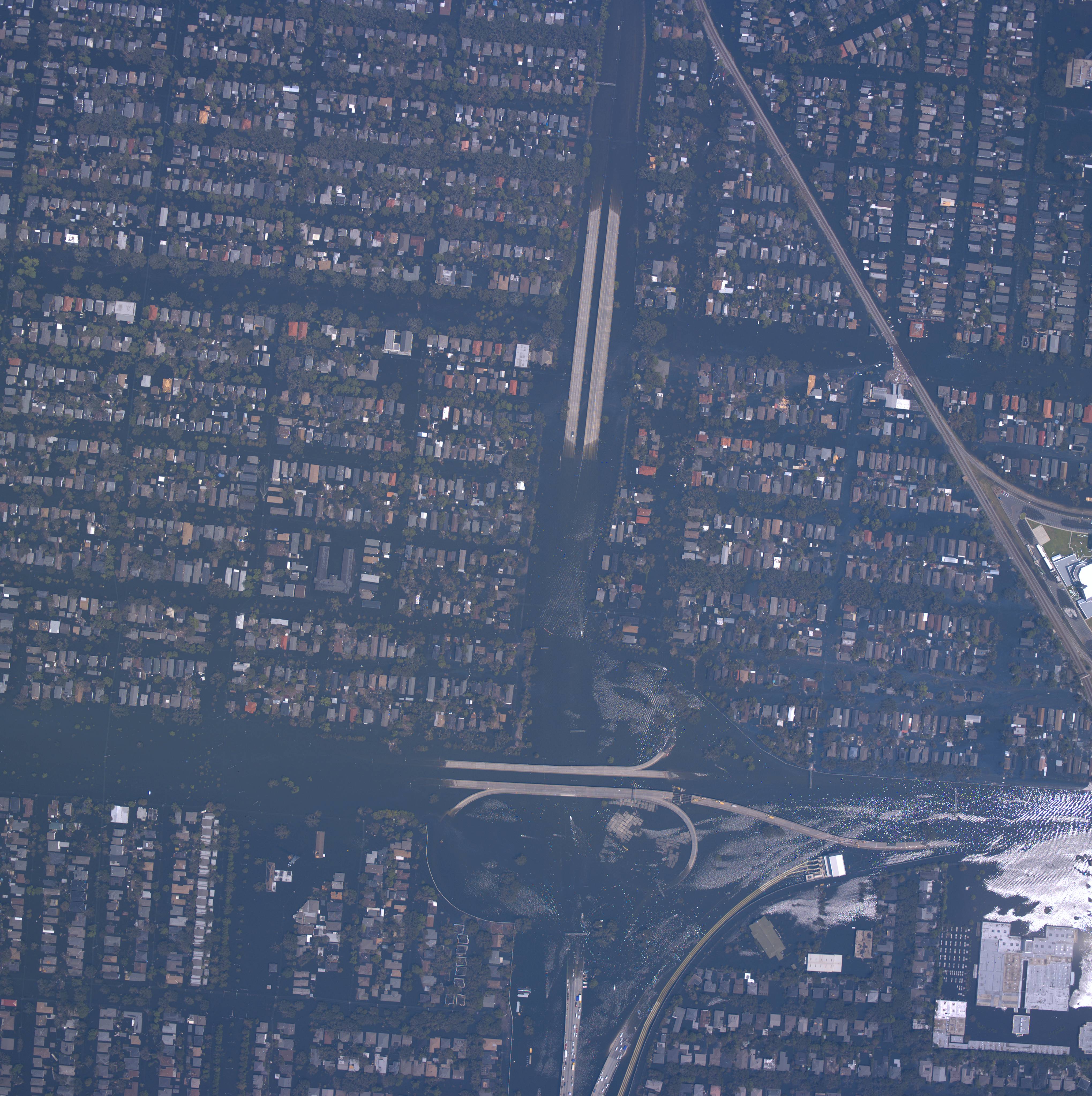
| 24426522-17-dip-lower-right.jpg
(1,750 KB) Can see Dip on lower right, large pump station with pipes going to 17th street canal. Morman Church. Veterans Hwy and I-10 cross canal. Can see rail road until just before it crosses over the dip. The dip is the Mound Ave Crossing by the cemetaries. |
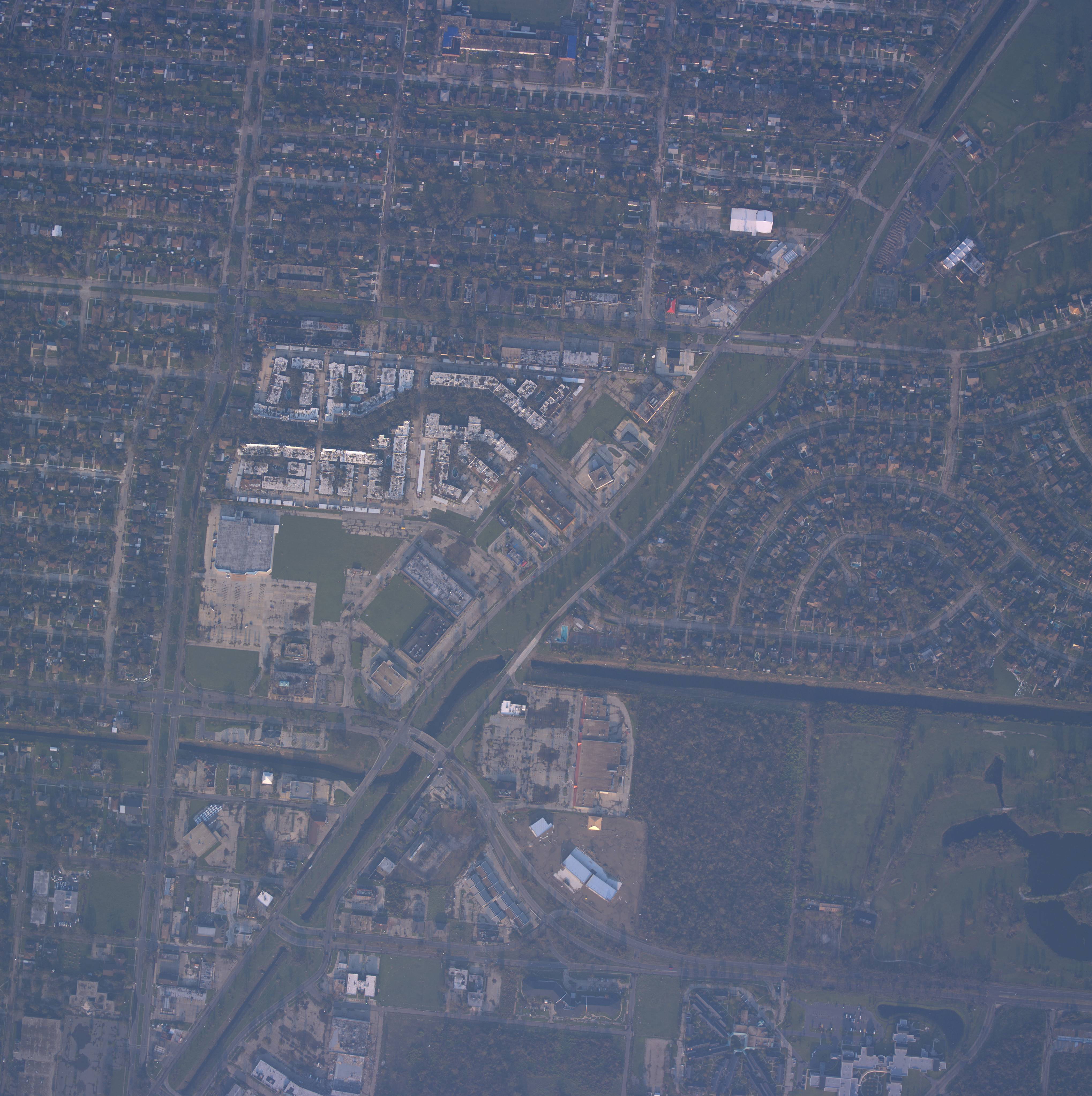
| Photo showing Park Timbers and the office on Kabel Drive (1,445 KB). The office is easy to find because of the red Pizza Hut roof. |
| Photo showing Huntlee and Somerset Drive (1,613 KB).Find the shopping center on the corner of Huntlee and Gen. Meyer to find Huntlee. Somerset is one street to the left and curve around. |