Katrina August 29, 2005

|
Katrina August 29, 2005
|
| This is what our levees and battures normally look like at the time of year Katrina struck. Notice the water is very low. The surge of water from the hurricane topped this 20 or 25 foot levee but since it did not erode, it did not break. These levees are some of the oldest in the area. We have 6" thick broken concrete rocks at the bottom near the river, a span of 50 or more feet of grass and some trees, and then the levee. The levee has a concrete slab on this side to help with erosion. It is usually anywhere from 6" to 8" thick. |
|
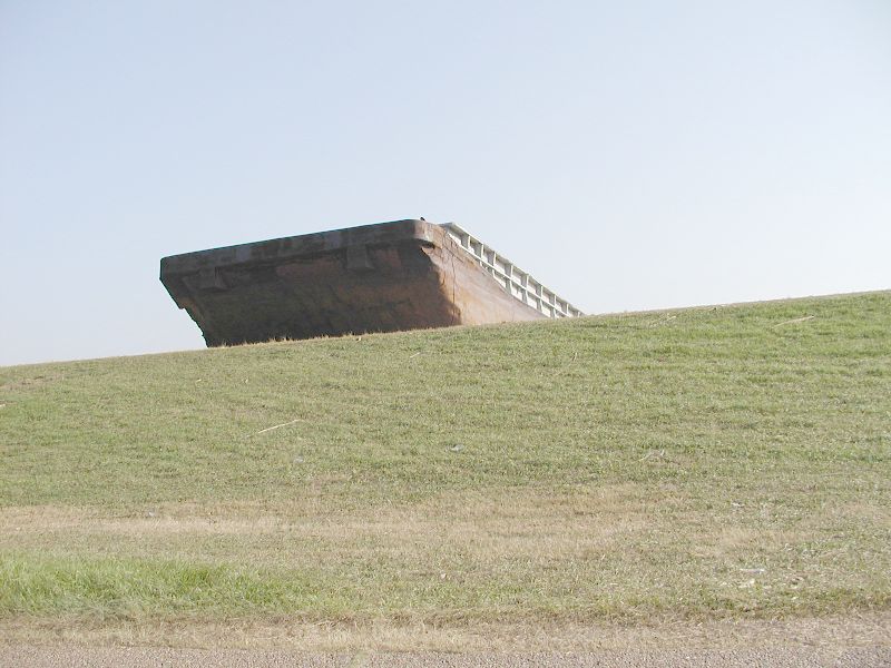
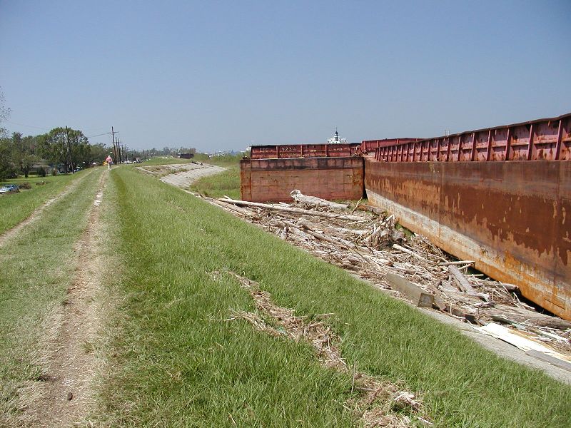
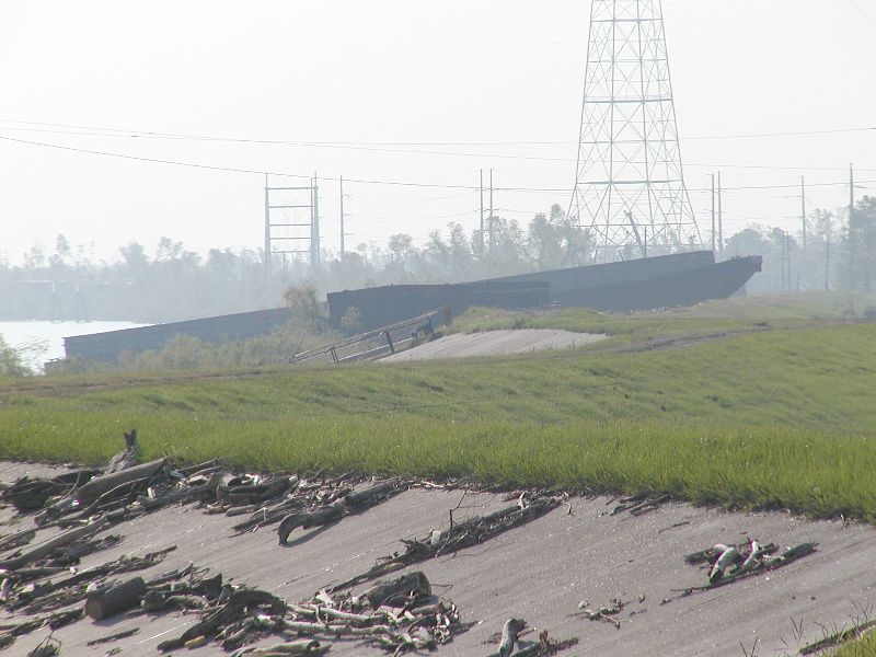
| Barges, empty and full floated all around and some ended on top of our levees. It took them weeks to remove them. Usually our river at this time of year is very low which is evident in some pictures. But, during the storm, the water came over the top of the levees, even as far north as New Orleans. Our Mississippi river levees are between 20 and 25 feet high. |
|
|
| Notice how low the houses are next to the levee. Actually, the closer you get to the levees, the higher the ground. But if the levee fails, how high would the water be? It is hard to imagine the water actually over the top of these levees. It looks so calm and low right now. These pictures were taken around 9-17-05, about 2 weeks after the first storm (Katrina). |
|
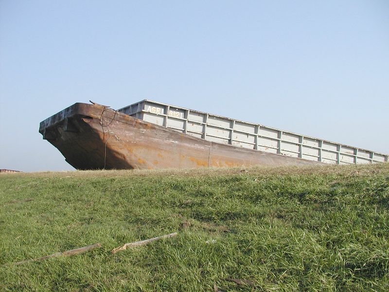
| There were 4 barges lashed together. One hit the levee from the previous picture, broke loose, and got stuck on the levee. These other three traveled on further leaving a gash in the cement erosion protection of our Mississippi River levee on the West Bank. To get an idea as to how large these barges are, look at the person walking on the levee and compare her height to the height of the barges. She is 5'6" tall which makes those barges over 20' tall. |
|
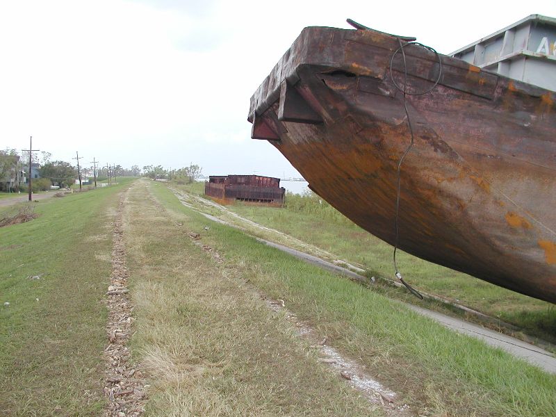
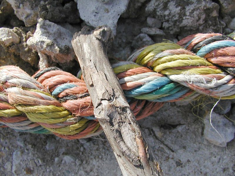
| The tell tale sign as to how big a gash is underneath this barge is the size of the rope hanging from this barge. These ropes are about 2.5" in diameter. I can hardly get my hand around them. The metal cables (in the background) were also part of the way they were lashed together and they are just about as large in diameter. Both failed in the storm. This gash is 16" deep. |
|
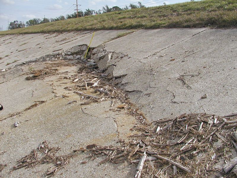
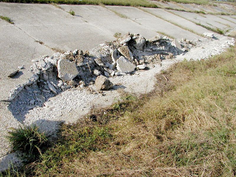
| After hitting the levee in several places and cutting at least two obvious gashes, this is where it finally rested. This gash is 18" deep as per the yard stick in center. Thickness of concrete at this gash is 6". Each cement piece is 10' wide. size of this gash spanned 5 sections (100'). |
|
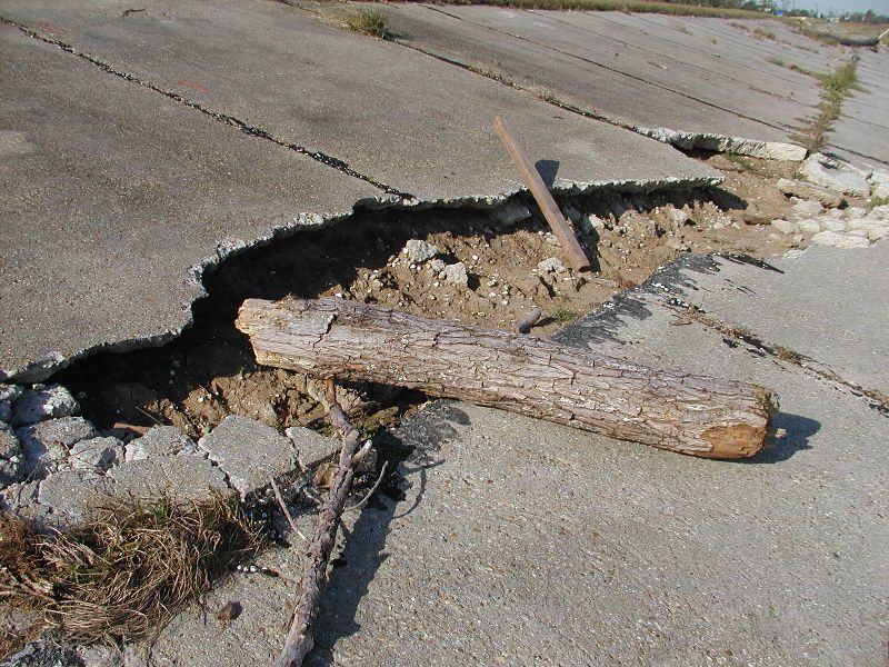
| This is one of the gashes left by the same barge as in the previous picture. It was taken after they lifted the barge off of the levee. That board is a 2x2. This gash is 12" deep as per the stick in center. Thickness of cement at this gash is 6" thick. Each cement piece is 10' wide. Size of this gash spanned 5 sections (50'). Notice how this gash has been scoured out by the water. I wonder what will happen during our normal spring high water? |
|
| Since I didn't have a yard stick, I picked up a stick and marked it so I would be able to gague the size of different things. I brought the stick home and measured it with a yard stick. This rope is 2.5" in diameter. |
|
| Some more barges stuck in the batture. It was pretty foggy the morning this picture was taken (9-16-05). |
|
| This gash is 16" deep below the concrete. The thickness of concrete at this gash is 16". Each cement piece is 10' wide and this gash spanned 10 sections (100'). |
|
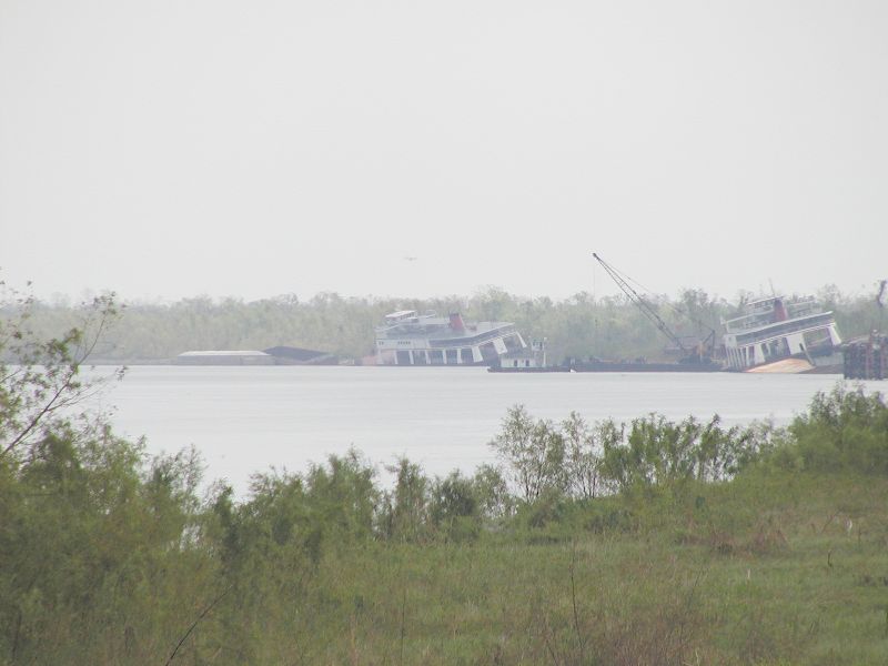
| These are our 2 ferries that take cars and people across the river at Chalmette.They were stuck in the batture. |
|
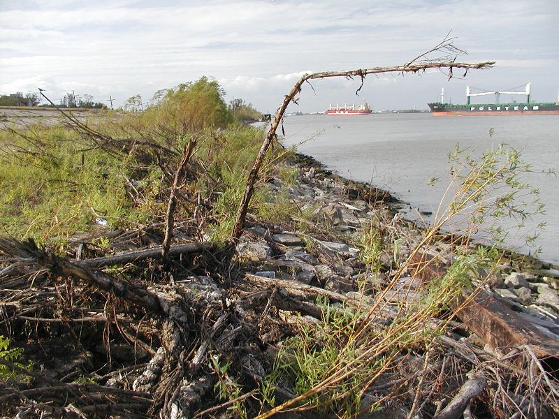
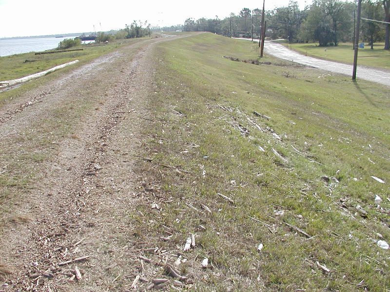
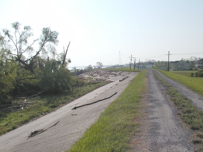
| Notice the real height of the Mississippi on the left side of the levee. On the right side of the levee, there is lots of driftwood. This indicates the river really did come over the top of the levee. We were very fortunate that this levee held. A man who stayed during Katrina said he saw the water coming over the top of the levee with all the driftwoood. He lives at the next curve of the levee in this picture. He didn't act like he wanted to stay again. |
|
| Notice the height of the houses in relation to the levee. |
|