| These are all pictures gleaned from the web. |
| Simplified explanation
of New Orlean's geography. From Southbear.com |
| Unofficial timeline from Thursday
August 25th to Thursday September 1, 2005. |
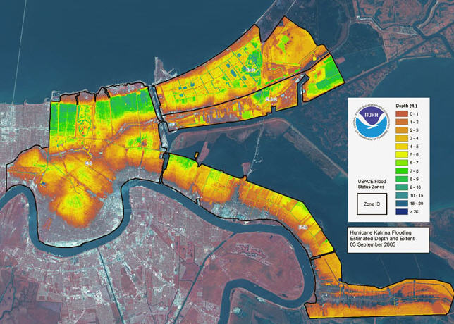
| Katrina Flooding Estimated Depth and Extent September 3, 2005
(NOAA). |
|
|
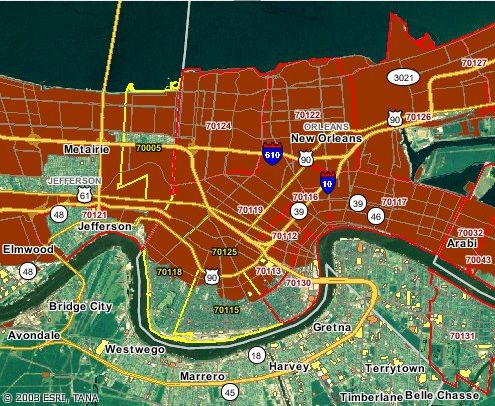
| Another flood map with zip codes. |
|
|
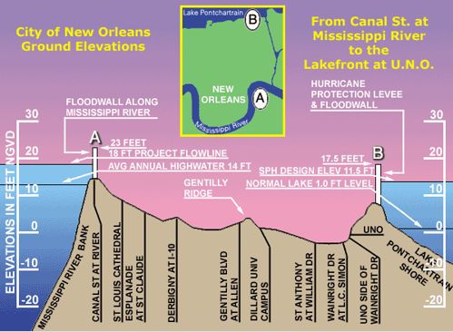
| Elevations in New Orleans |
|
|
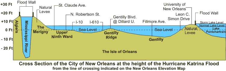
| Here is another example of an elevation map. |
|
|
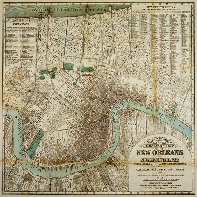
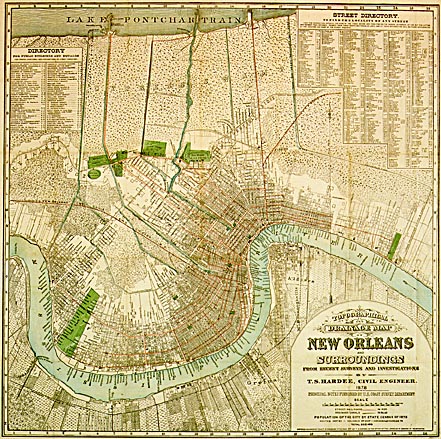
| This is a map of the population of New Orleans in 1878. Almost
nothing would have been flooded if we had not expanded or grown since then.
Here's a bigger map of the same thing. |
|
|
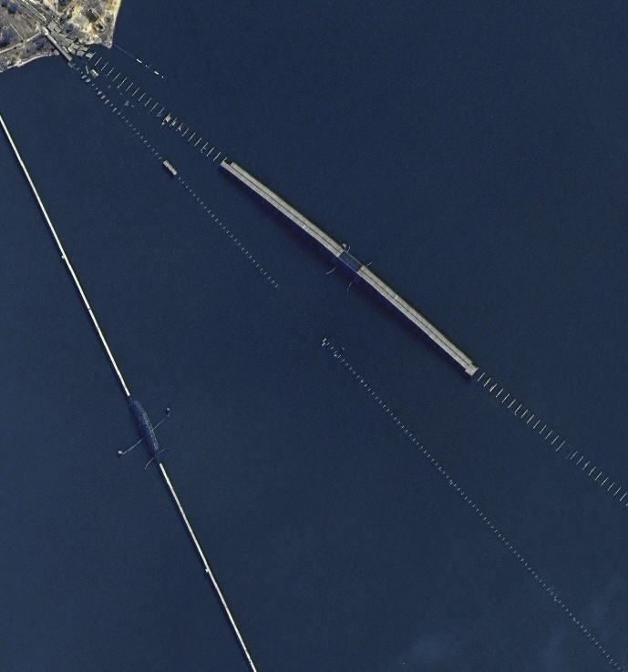
| Slidell bridge, Hwy 11 bridge, and rail road bridge after
storm. THey picked up the pieces and had it back together within a month
after the storm. These bridges are mainly put together like blocks. One
piece just rests on another. |
|
|
| The rest of these links are very large so to look at them,
you have to download them. Just right click on the link and choose save
as. |
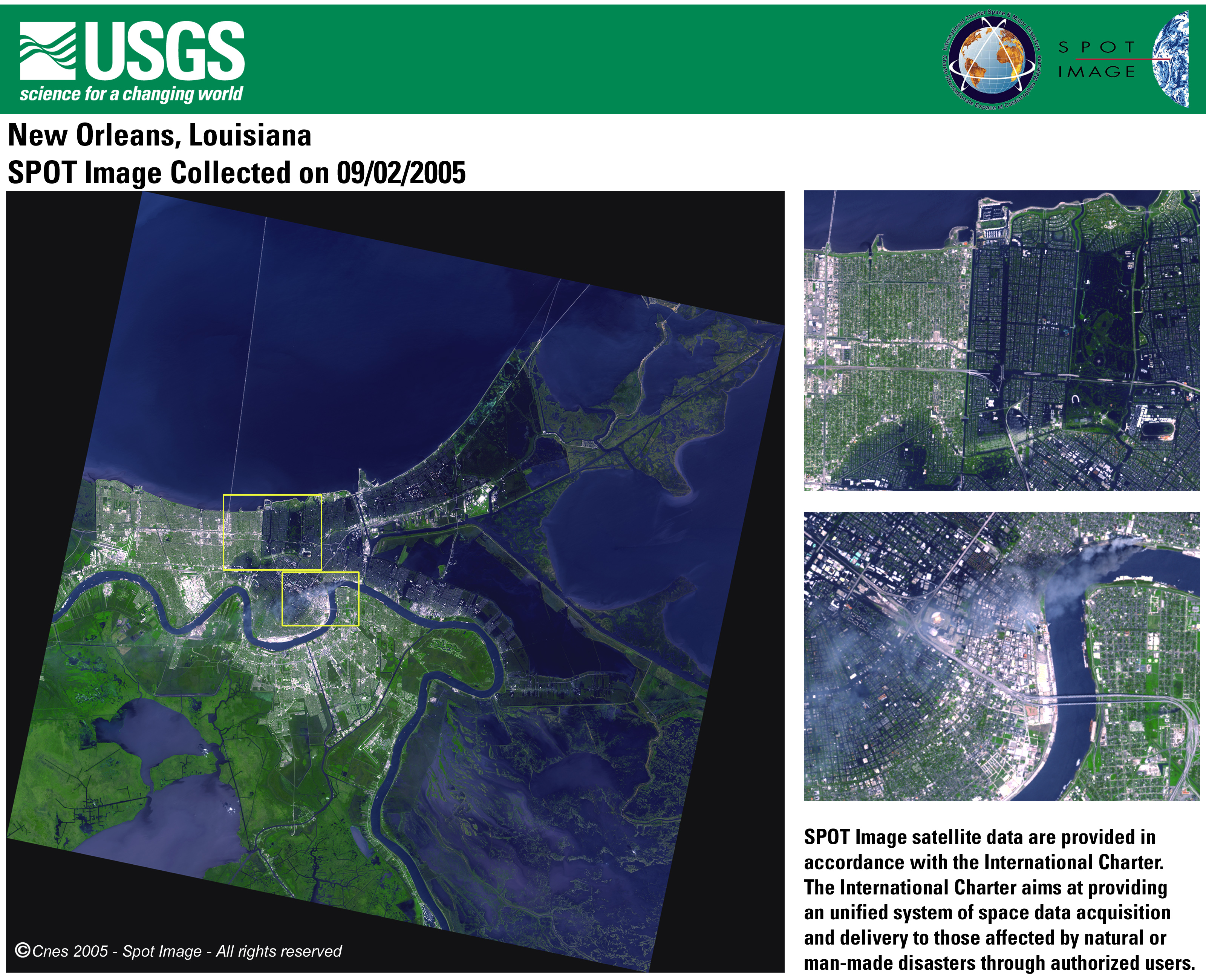
| Good picture of flooding from satelite (3,047KB)
z-SPOT_090205_NewOrleans_Poster.jpg |
| Good picture of flooding from satelite - MUCH BIGGER (24,381KB)
z-SPOT_090205_NewOrleans_Poster.tif |
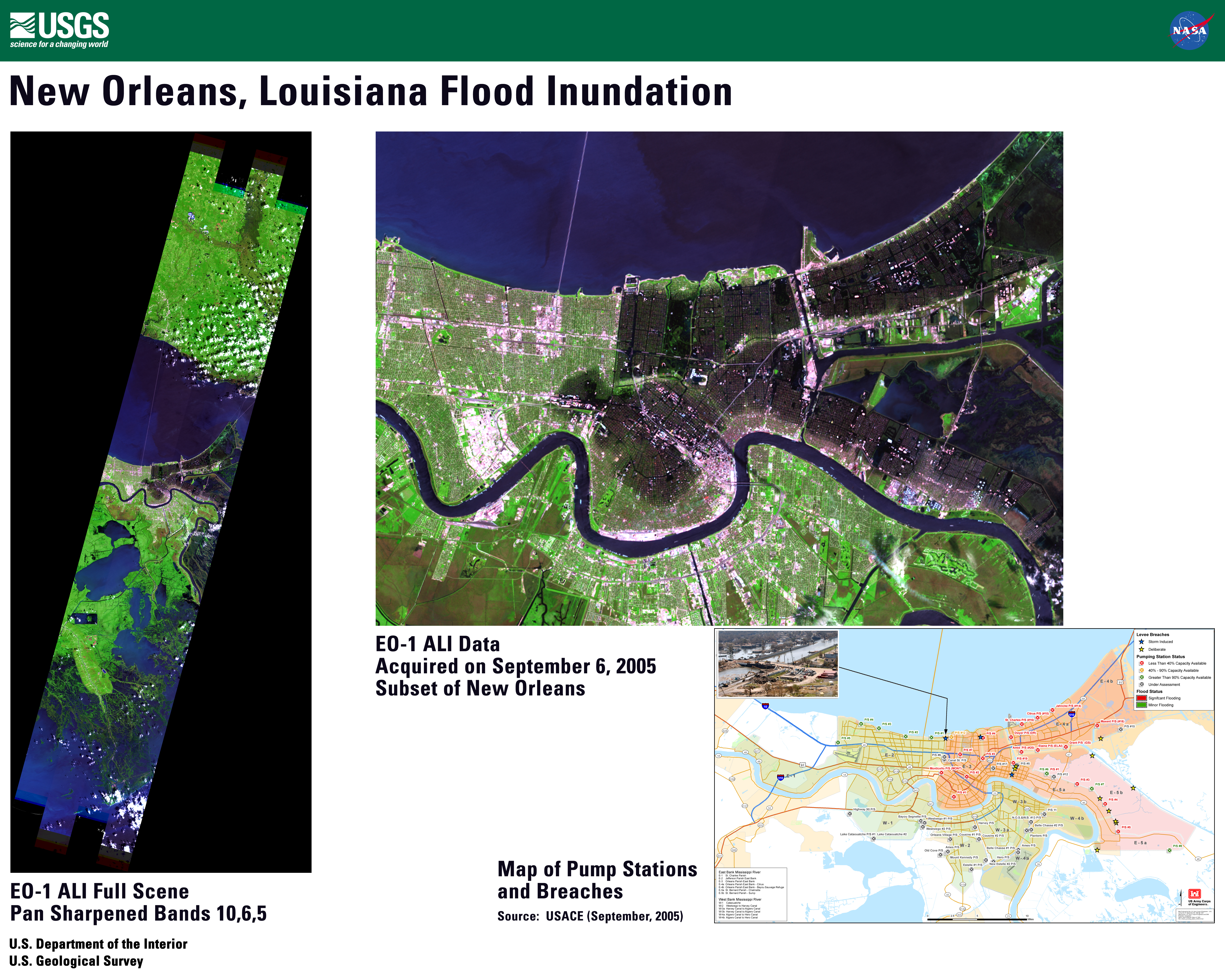
| Good picture of flooding from satelite (11,283KB)
z-EO-1_ALI_Katrina_poster_v4f.jpg |
| Good picture of flooding from satelite - (3,007KB)
z-SPOT_Image_090205_NewOrleans.pdf |
| Where the victims were found (2,185KB)
z-victims-found.pdf |
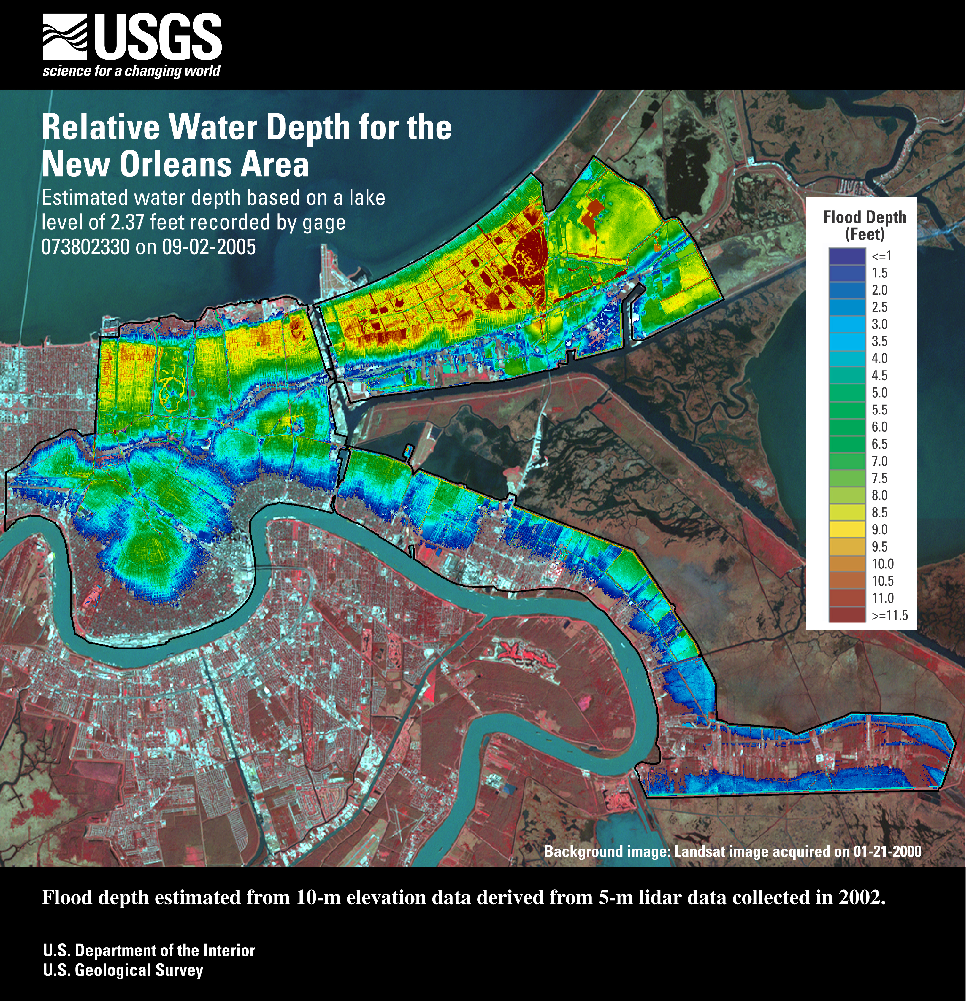
| Water depth poster (8,860KB)
z-waterdepthposter-usgs-2005-09-02.jpg |
| |
| Other interesting links. |
|
|
| |