|
Late December 2005
Industrial Canal Breaks, Lower 9th Ward, and St. Bernard Parish
Page 1 of 2 |
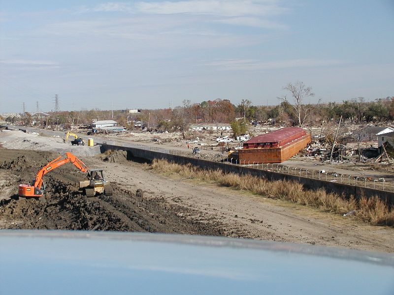
| View from the North Claiborne Ave. Bridge.
The camera could only fit part of the area totally destroyed. |
| |
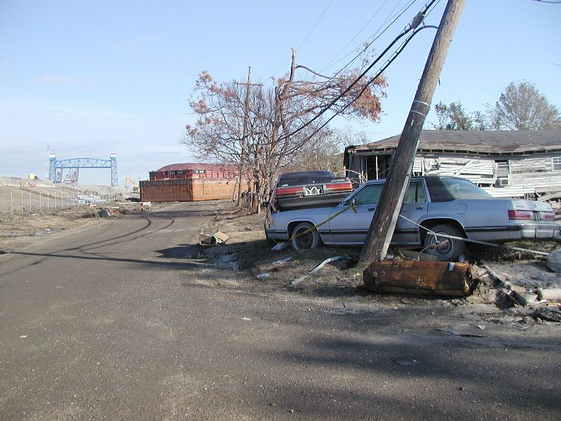
| This is the barge that broke through the levee
which is on the right. The N. Claiborne Ave bridge is in the background.
The other break was by the Florida Ave. Bridge about 12 blocks behind the
camera. |
| |
| |
| |
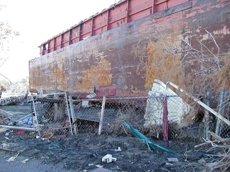
| The barge landed in someone's yard and the mail box is
pretty much the only thing left. |
| |
| However there was the inside to a crawfish pot almost
underneath it. |
| |
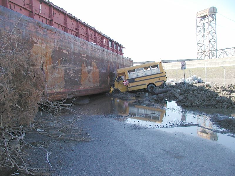
| The camera is now facing the other way toward the Florida
Ave. Bridge. |
| |
| |
| |
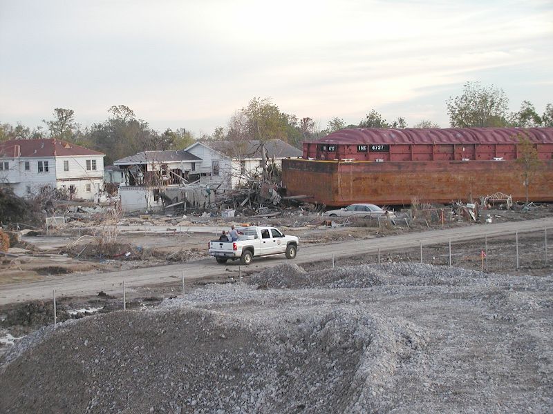
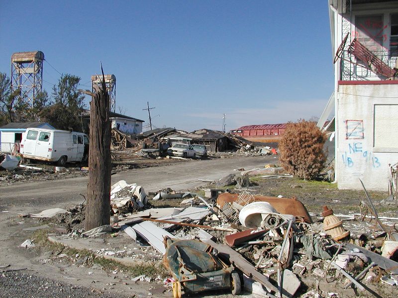
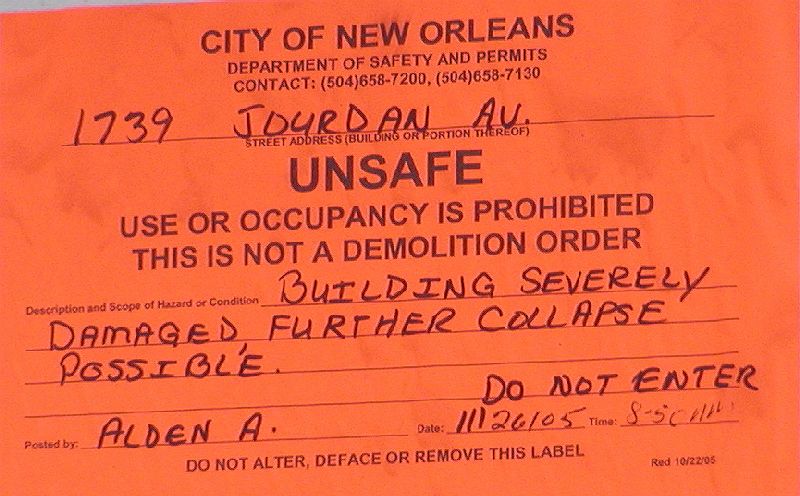
| The barge pushed the house away from its foundation
and wrecked another one. This house, right next to the barge, has an orange
sticker on it warning people of the dangerous conditions of the house. But
if this was all that was left of my house and I there was a chance to find
some things, like pictures, or sentimental jewelry in sealed containers... |
| |
| |
| |
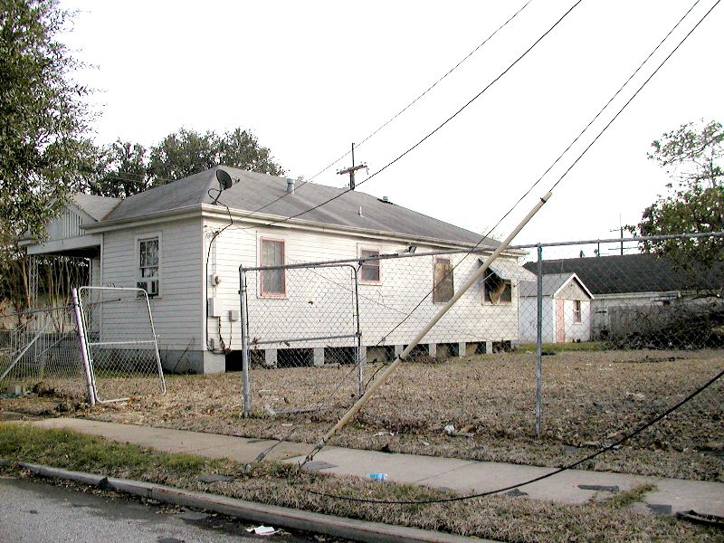
| This house over on Burgundy Street (70117) has a hole
in the roof where someone was rescued. He said the Fish and Wildlife boat
that rescued him scooted right over his 8 foot chain link fence with no
problem. This house is 20 blocks from the Industrial Canal break and the
water was up to the attic. |
| |
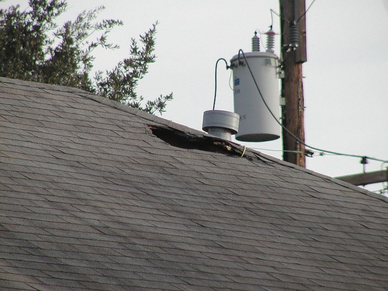
| This is a shot of the hole in the roof from the house
right above. |
| |
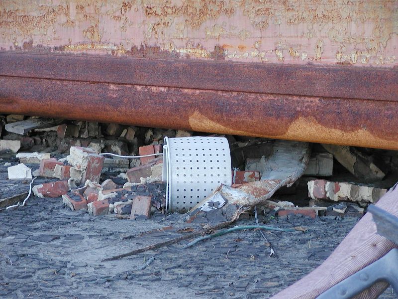
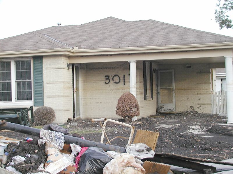
| If your house was still standing, and it could be saved,
this is what residents have to look forward to. There is so much mud, inside
as well as outside the house that cleanup is very difficult. When finished
cleaning as much as possible and taking down the drywall and insulation
to the 2x4 studs they still have to open the doors and hose out the mud
that couldn't be shoveled out. The mud in this picture is anywhere from
2 to 4 inches think. |
| |
| Looking closely just under the eave of
this house is lots of dirt and debris. The water came over the roof line
here and when it receeded, lots of the debris splashed and stuck to the
soffets. The picture below this one shows it better. |
| |
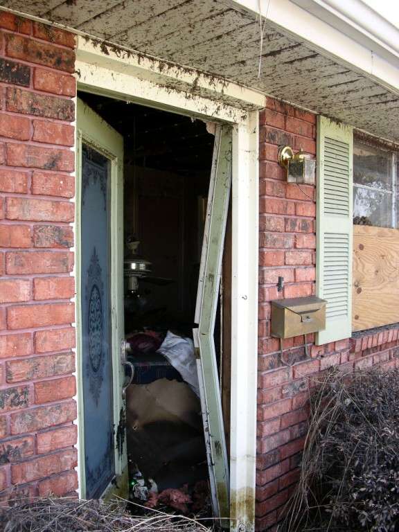
| The inside of this house has been digitally
lightened so the mess inside is easier to see. The ceiling fell and the
fan fell with it. The fan is only held up by the Romex attached to it. To
see the original picture, just click on the one below. I got this picture
from http://www.mgcollins.com/Katrina/PicturePage2.html |
| |
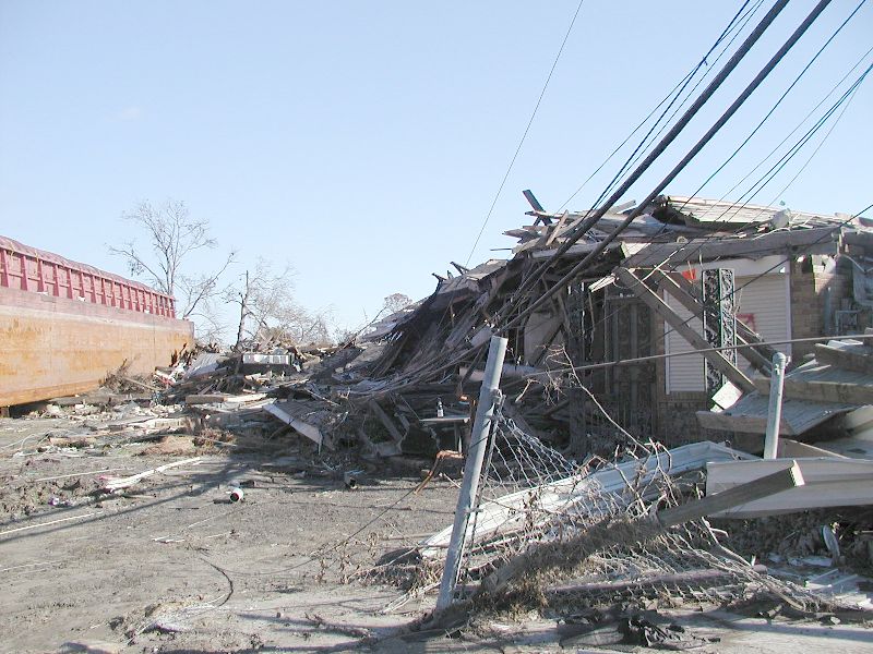
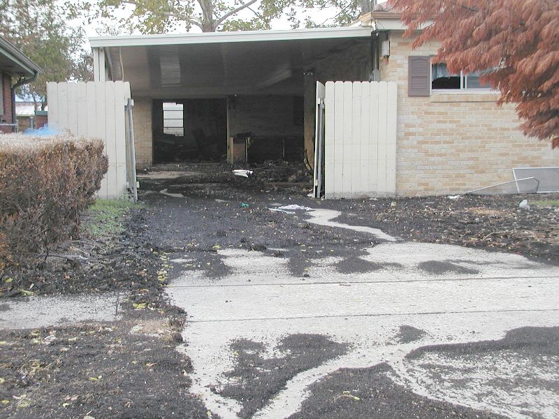
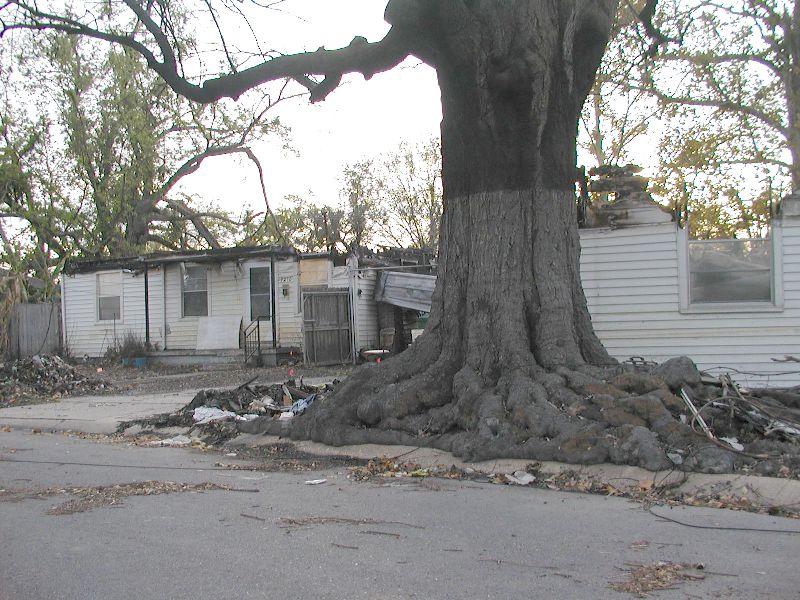
| These two houses burned right down to
the water line while the water was still about 8 feet deep. Notice the soot
mark on the tree. The tree seems to be coming back. There were lots of tiny
new green leaves. The house on the right, fell off of its piers and moved
forward, probably breaking a gas line starting a fire. |
| |
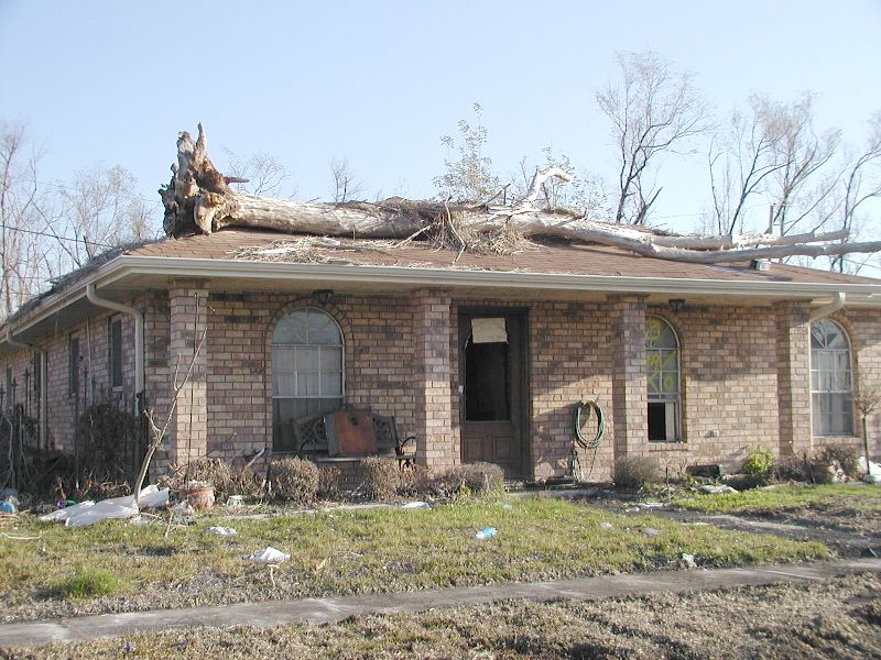
Further on down toward Mereaux and
Arabi the damage was much worse than in New Orleans.
The water was over the top of the houses as this tree and that marsh grass
which floated on top of the roof. |
|
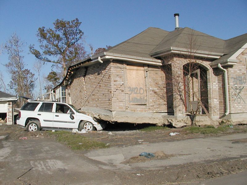
| Water in this area was over 17 feet high. My friend's
daughter's house floated on top of her brand new SUV. |
|
| |