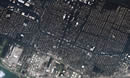
133699main_iss_neworleans_516.jpg (69K)
Found at: http://www.nasa.gov/vision/earth/lookingatearth/h2005_katrina.html
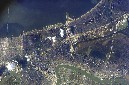
The extent of flooding in the greater New Orleans metropolitan area is clearly visible in this image, acquired from the International Space Station on September 8, 2005, of areas damaged by Hurricane Katrina. Flooded areas are dark greenish brown, while dry areas to the west of the 17th Street Canal and along the banks of the Mississippi River (lower half of image) are light brown to gray. This cropped image (from the parent frame ISS011-E-12527) is oriented with north to the top. Credit: NASA
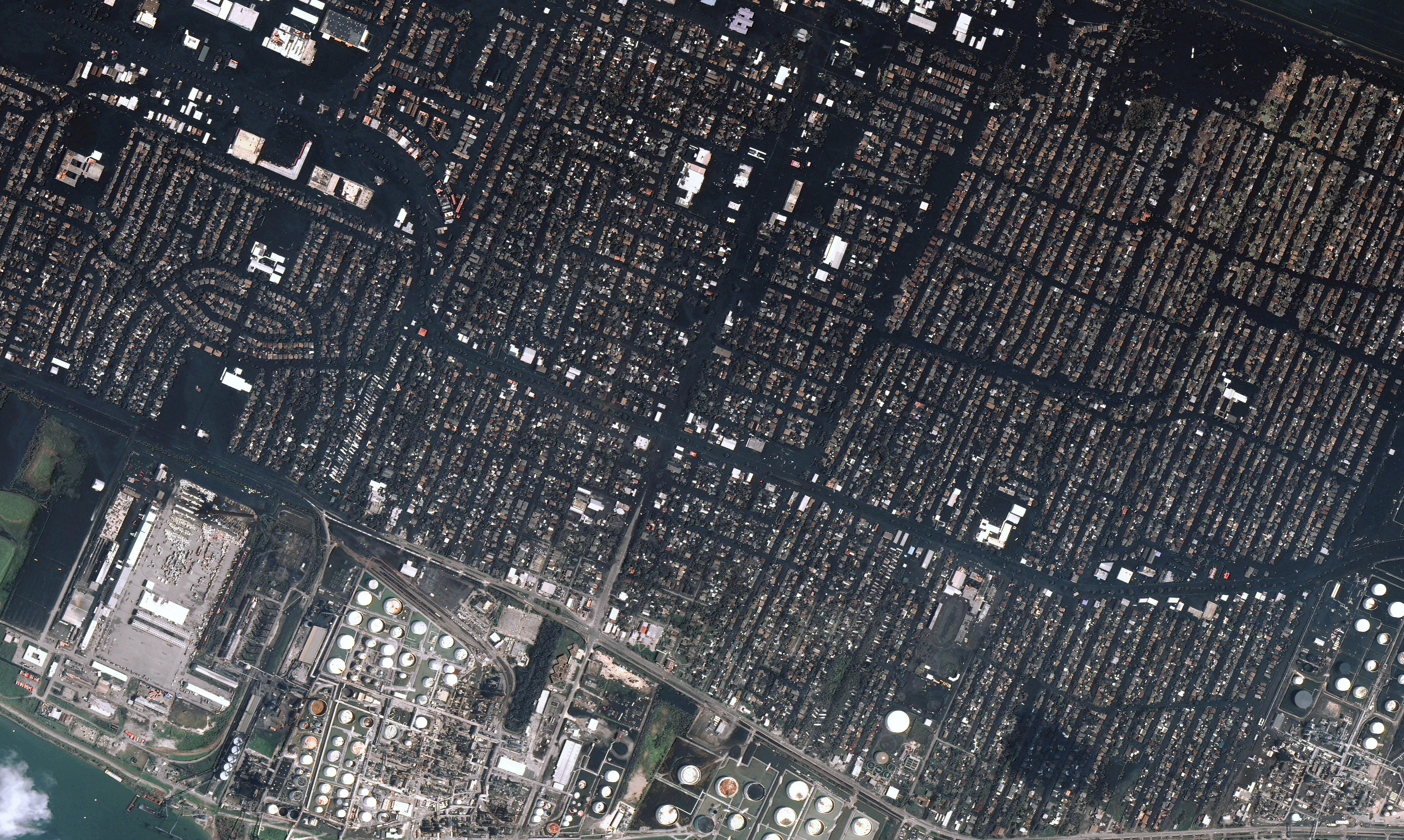
134343main_neworleans_l7_15sep05_15m.jpg (2,093 KB).
found at: http://www.nasa.gov/vision/earth/lookingatearth/h2005_katrina.html
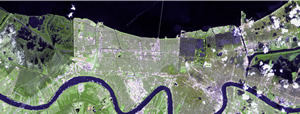
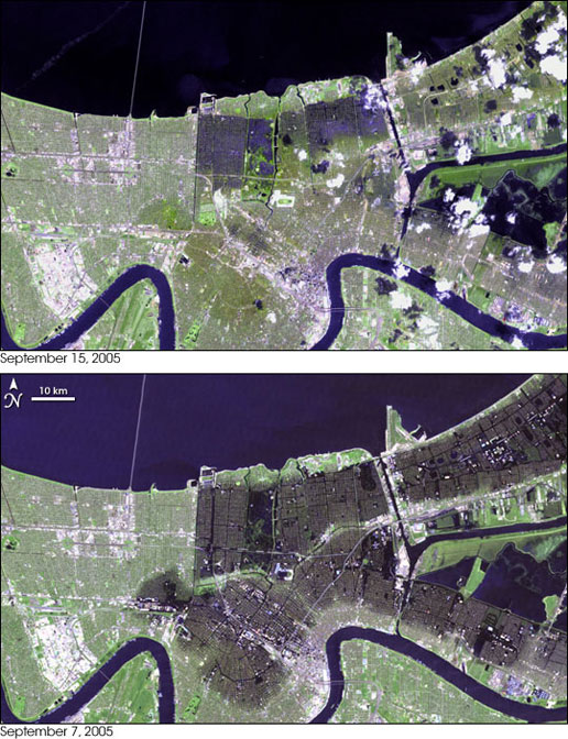
The floods that buried up to 80 percent of New Orleans had noticeably subsided by September 15, 2005, when the top image was taken by the Landsat 7 satellite. In the two and a half weeks that had passed since Hurricane Katrina flooded the city, pumps had been working nonstop to return the water to Lake Pontchartrain. As portable pumps were brought in to supplement the permanent pumps already hard at work, as much as 380 cubic meters (380,000 liters or 23,190,000 cubic inches) of water were being pumped out of New Orleans every second, according to the U.S. Army Corps of Engineers.
The progress in draining the city is evident when the September 15 image is compared with an image taken one week earlier. In the lower image, taken by the Landsat 5 satellite on September 7, black flood water covers much of the city. By September 15, the dark flood water had all but disappeared, lingering only in a few sections of the city. The September 7 image does not show the full extent of the flooding. Taken more than a week after the hurricane struck New Orleans, the image shows a flooded city that had already started to drain. In a similar (but cloudy) image taken on August 30, the flood water in St. Bernard Parish, image right, extends almost to the Mississippi River. Credit: Images provided courtesy of the United States Geological Survey Center for Earth Resources Observation & Science (CEROS).
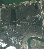
134344main_neworleans_sep05_516.jpg (120K)
Found at: http://www.nasa.gov/vision/earth/lookingatearth/h2005_katrina.html
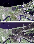
The bottom picture shows the flooding on September 7, 2005 and the top one shows flooding on September 15, 2005.
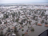
| Brian-Deubler-Buckaneer-Villa.jpg (19KB)
http://photos1.blogger.com/blogger/4806/1507/1600 /Brian%20Deubler%20Buckaneer%20Villa.jpg This is in St. Bernard parish. |
 |
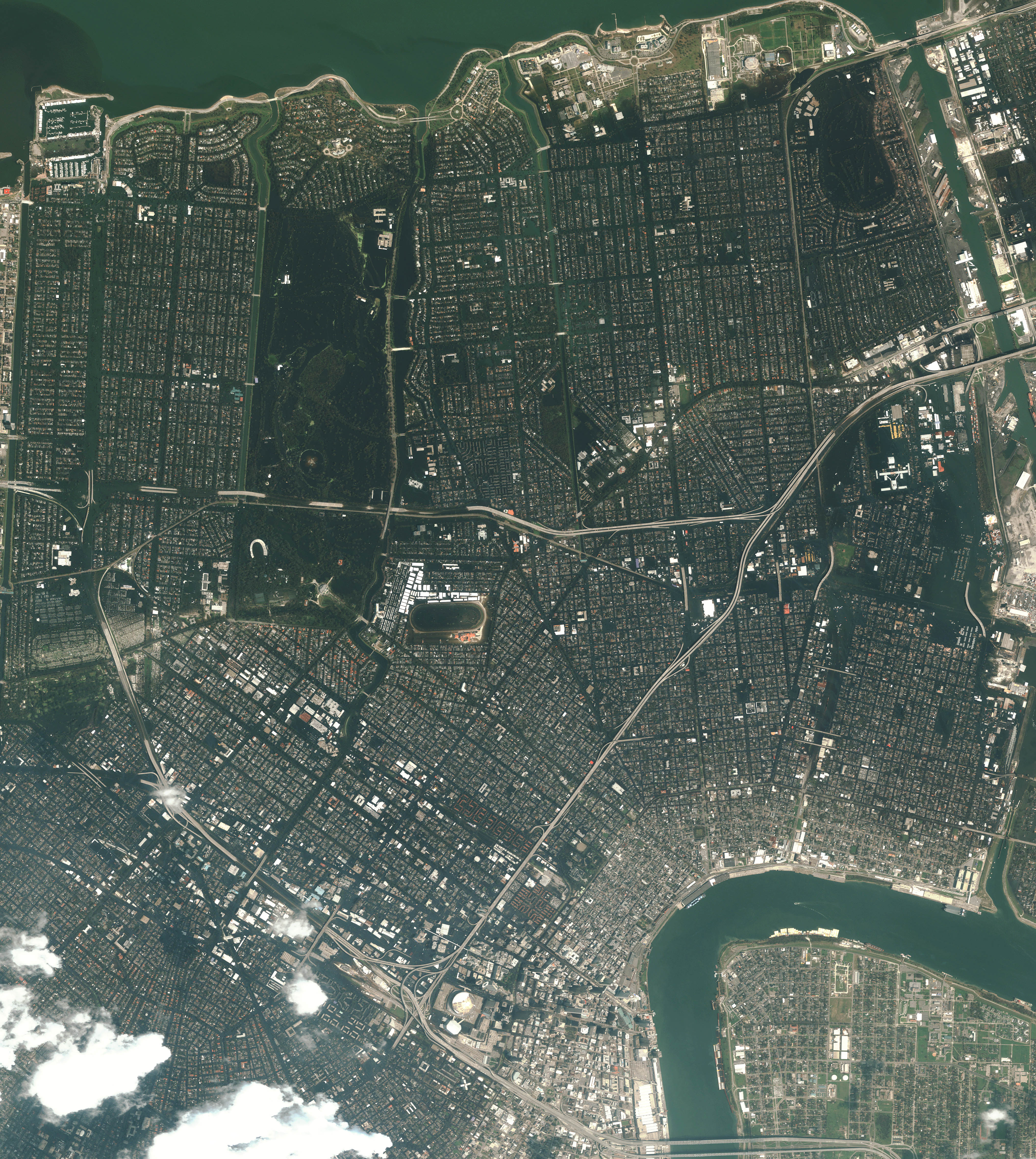
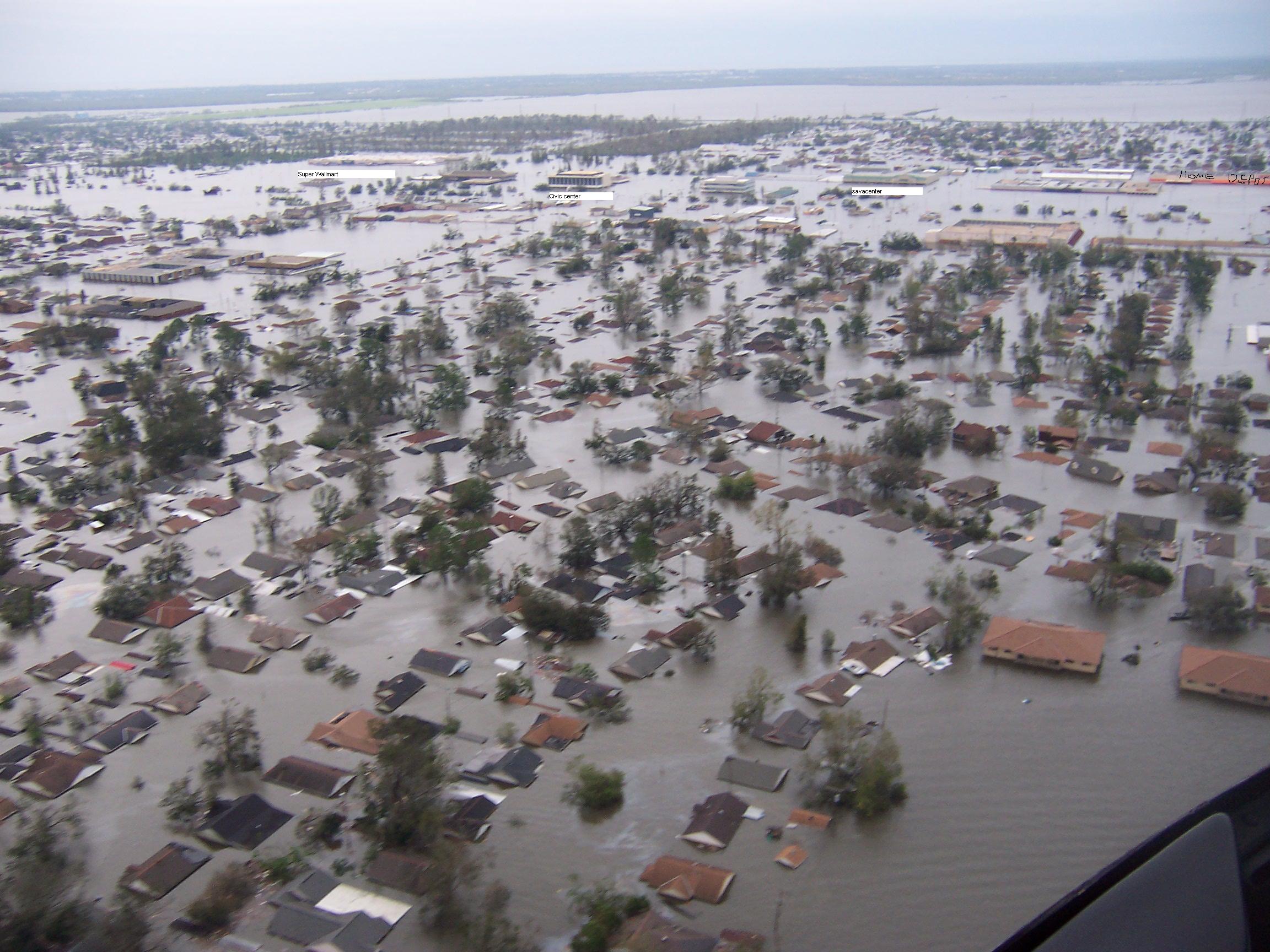
Chalmette and New Orleans flooding on August 31.
new_orleans_chalmette_aug31_2005_dg.jpg (4,275 KB)
http://www.digitalglobe.com/images/katrina/new_orleans_chalmette_aug31_2005_dg.jpg
Flooding in New Orleans August 3005.
new_orleans_msi_aug31_2005_dg.jpg (3,297 KB)
found at: http://earthobservatory.nasa.gov/Newsroom/NewImages/images.php3?img_id=17020
Taken very soon after the flooding began. I can't remember where I found it but this is what Chalmette looked like. Some rooftops can't be seen because the water is covering them. omg.jpg (472 KB)